Your Geo Web Specialist
With TuxGeo+ location intelligence platform you can incorporate location information into your data analysis, gain deeper insights, identify patterns, and make informed decisions based on the geographic context of your data.
![tuxgeo 2nd latest mockup](https://tuxgeo.com/wp-content/uploads/2023/07/tuxgeo-2nd-latest-mockup-1024x654.png)
![tnb mockup wording1](https://tuxgeo.com/wp-content/uploads/2023/08/tnb-mockup-wording1-1024x654.png)
Our Products
With TuxGeo+ location intelligence platform you can incorporate location information into your data analysis, gain deeper insights, identify patterns, and make informed decisions based on the geographic context of your data.
![](https://tuxgeo.com/wp-content/uploads/2023/07/tuxgeo-enterprise.png)
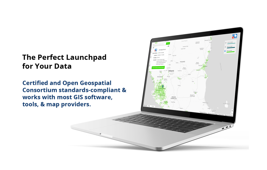
TuxGeo+® for Enterprise
Fit for all map visualisation platform
used to visualise your data and fuse it
with 3rd party data for operation and
analysis
- Fast rendering multi-layers visualization & layer management
- Map intelligence and geospatial analysis
- Integration with open-source such as ERP, CRM, SCADA
- Data visualization, collaboration and sharing
- Customizable and responsive operational and business dashboard
![](https://tuxgeo.com/wp-content/uploads/2023/07/tuxgeo-address.png)
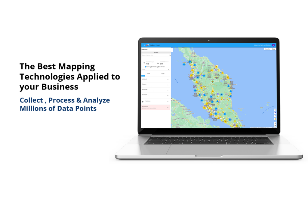
TuxGeo+® Address Management
Mobile apps platform that emphasize on data collection, monitoring, work force, job orders, tickets and map visualisation
- Address validation & standardization with MS 2039 : 2006 Standard
- Batch processing geocoding through multiple data sources
- Data enrichment with 3rd party data such as demographic & property details
- Accuracy analysis and scoring reports
![](https://tuxgeo.com/wp-content/uploads/2023/07/tuxgeo-transit.png)
TuxGeo+® Transit
A suite of products thats include a geocoding engine, addresses enhancements and management
- Real-time tracking of moving assets with GPS trackers or mobile devices
- Asset identification, tagging and inventory
- Integration with other operational & business workflows and use-cases
- Geofencing, alerts and on-site reporting
- Geo-targeted or geo-triggered information deliveries
![](https://tuxgeo.com/wp-content/uploads/2023/07/tuxgeo-vision.png)
TuxGeo+® Vision
A platform for tracking all moving IoT with tracking device either by GPS tracker or mobile complete with maps and advanced features
- Mobile workforce tracking and reporting
- Asset or data auditing, data collections & asset details verifications
- Task assignment, task documentation & management
- Workforce performance and summary dashboard
- Offline capabilities for areas with limited connectivity
Why TuxGeo+ ?
User Friendly
Compared to traditional GIS software, TuxGeo+ is easier to use for non-GIS non-technical people with multiple modules based on your specification, use-case and business or operational pain-points
Resources
All level of personnel can access the web-based TuxGeo+. No need to wait for GIS specialist to prepare the view & data that you need
Cloud
TuxGeo+ can be hosted fully on any cloud service of your choice, hybrid cloud or on-site with minimum infrastructure and ability to load balance and automatic scaling through Kubernetes
Cost
Compared to traditional GIS software, TuxGeo+ doesn’t count unique users or workplaces as licenses instead we count concurrent users. TuxGeo+ can be accessed at all time through web browser, mobile web & mobile apps without usage credits
![](https://tuxgeo.com/wp-content/uploads/2023/07/20985584_104-514x1024.png)
Our Partners
This partnership represents a significant milestone in our shared commitment to delivering exceptional products and services to our clients.
We aim to leverage the respective strengths and expertise to drive significant growth and create unparalleled value for our customers and stakeholders.
![cesium](https://tuxgeo.com/wp-content/uploads/2023/07/cesium.png)
![excellion](https://tuxgeo.com/wp-content/uploads/2023/07/excellion.png)
![google](https://tuxgeo.com/wp-content/uploads/2023/07/google.png)
![open geospatial](https://tuxgeo.com/wp-content/uploads/2023/07/open-geospatial.png)
![maps people](https://tuxgeo.com/wp-content/uploads/2023/07/maps-people.png)
![tulus2](https://tuxgeo.com/wp-content/uploads/2023/07/tulus2.png)
Our Clients
For years, we’ve partnered with companies from many industries to help them gain control and understanding over their location data. Let us show you what insights and opportunities you can discover with yours
![](https://tuxgeo.com/wp-content/uploads/2023/07/TNB.png)
![](https://tuxgeo.com/wp-content/uploads/2023/07/TM-01.png)
![](https://tuxgeo.com/wp-content/uploads/2023/07/LZS.png)
![](https://tuxgeo.com/wp-content/uploads/2023/07/MCMC.png)
![](https://tuxgeo.com/wp-content/uploads/2023/07/Maxis.png)
![](https://tuxgeo.com/wp-content/uploads/2023/07/JUPEM.png)
![](https://tuxgeo.com/wp-content/uploads/2023/07/JKR.png)
![](https://tuxgeo.com/wp-content/uploads/2023/07/LHDN.png)
![](https://tuxgeo.com/wp-content/uploads/2023/07/ISN.png)
![](https://tuxgeo.com/wp-content/uploads/2023/07/PDRM.png)
![](https://tuxgeo.com/wp-content/uploads/2023/07/Indah-water.png)
![](https://tuxgeo.com/wp-content/uploads/2023/07/Austin-powder.png)